Matrice 4 Enterprise
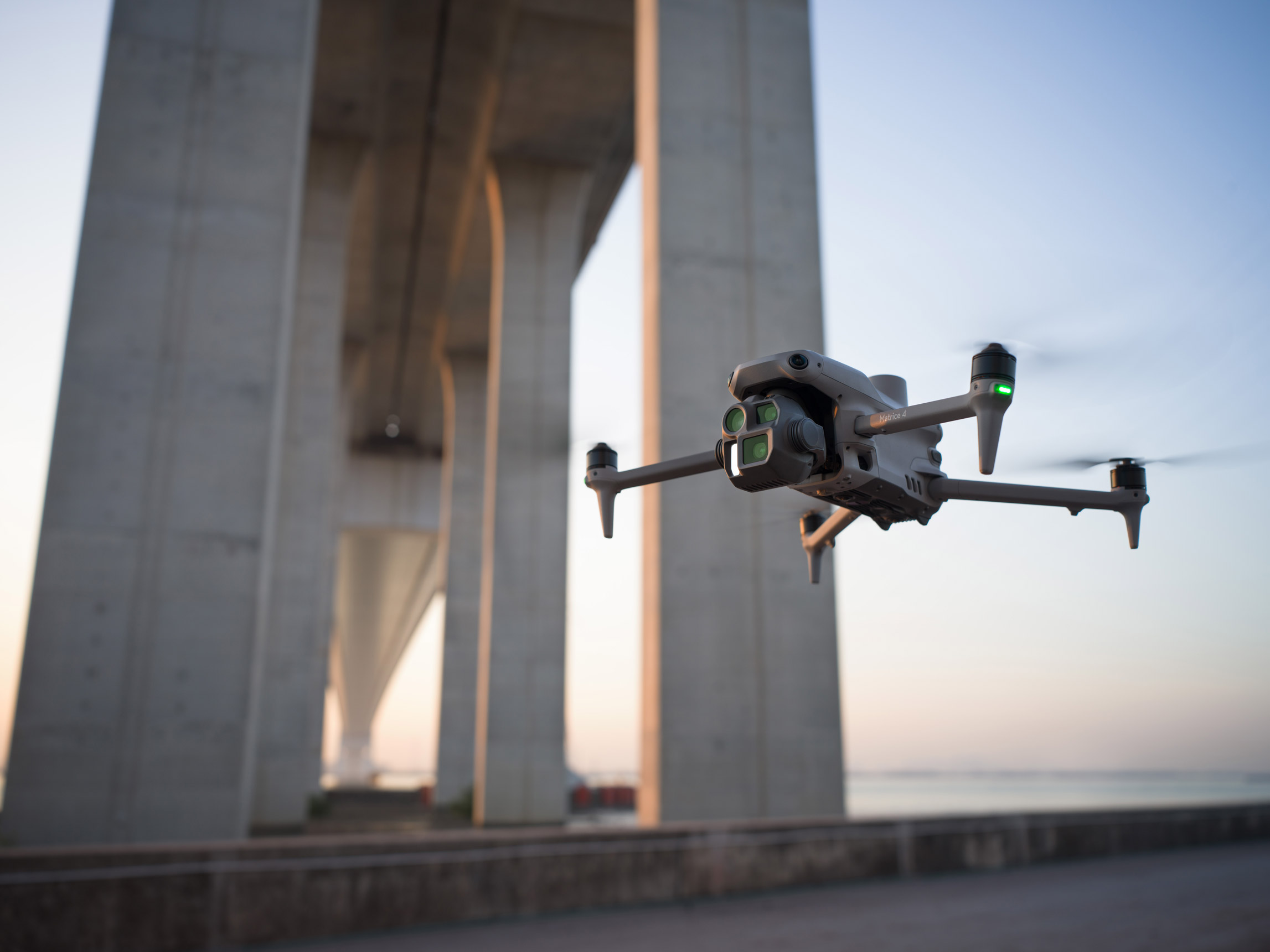
The DJI Matrice 4 Enterprise offers advanced AI, enhanced sensing, and a laser range finder for safer enterprise operations. The 4E targets surveying and construction industries. Upgraded accessories boost their capabilities for intelligent aerial tasks.
The DJI Matrice 4 Series introduces a compact, intelligent flagship drone lineup for enterprise use, featuring the Matrice 4T and Matrice 4E. Equipped with advanced AI, enhanced sensing, and a laser range finder, these drones offer safer and more reliable operations. The Matrice 4T is ideal for industries like electricity, emergency response, public safety, and forestry, while the Matrice 4E focuses on geospatial applications like surveying, construction, and mining. Upgraded accessories further enhance their capabilities, marking a new era in intelligent aerial operations.
- 1219g Takeoff Weight
- 6000m Max Altitude
- 49-Min Max Flight Time
- O4 Enterprise Transmission
- 14º to 104º F Operating Temperature
- Size: 307 x 387.5 x 149.5 mm
- Omnidirectional Obstacle Avoidance
- Remote ID: Yes
- GPS, GLONASS, BeiDou, Galileo
Product Highlights
Intelligent Operation Functions
Excels in Low-Light Environments
Clear Vision and Stable Images
High-Efficiency Precision Mapping
Enhanced Flight Safety
Comprehensive Accessory Upgrades
AI Power for Smarter Operations
The built-in AI model can detect vehicles, vessels, and subjects during search and rescue operations or routine flights. It also supports switching to other models, enabling the expansion of AI application scenarios. Additionally, it supports high-res grid photos and features powerful tracking capabilities.
Laser Range Finder, Precise Measurement
The laser range finder enables real-time precise measurement. Through simple operations such as pin point, line drawing, and area calculation, it can complete tasks like marking target locations for inspection purposes or calculating the area of a wildfire. Additionally, users can share info via the DJI Pilot QR code or FlightHub 2 with relevant personnel to enhance collaboration and workflow efficiency.
Super Resolution Telephoto
The tele camera of the Matrice 4 series has significantly improved clarity, featuring 48 MP resolution, capable of capturing incredibly details from signs up to 250 meters away. [7] Additionally, the Matrice 4T is equipped with an IR-Cut Filter, ensuring 24/7 operations.
Enhanced Medium Telephoto
The Matrice 4 series is equipped with a medium tele camera, expanding its capabilities for medium-range inspection tasks. During power line or bridge inspections, it can detect screws and cracks from a distance of 10 meters and clearly read instrument data at substations.
APPLICATION SCENARIOS
Discover the evolution of industrial operations with drones. Learn about their practical applications within your specific industry.
Talk To Our Experts
Get in touch with us to schedule a meeting with one of our team members at MultiCopter Warehouse, where we can discuss and tailor the perfect solution for your needs.


