
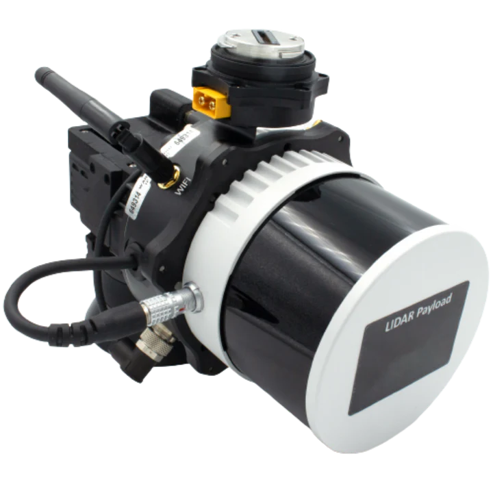
RESEPI Lite XT-32M2X
The RESEPI XT-32M2X is a lightweight, high-performance LiDAR mapping system built for drones, vehicles, and handheld platforms. Featuring Hesai’s advanced XT-32M2X sensor, it delivers extended range, wide field of view, and exceptional accuracy—perfect for large-area surveys in land surveys, construction, utility mapping, and more.
Highlights:
- Multi-Platform Ready: Mounts easily on UAVs, vehicles, and handheld systems.
- Enhanced LiDAR Performance: Extended range and vertical FOV with the XT-32M2X sensor.
- Wide Application Use: Ideal for utilities mapping, construction, agriculture, forestry, mining, and more.
- Efficient Coverage: Optimized for longer flight times and higher AGL missions.
- High Accuracy & Density: Delivers best-in-class point cloud quality for professional-grade results.
Engineered for flexibility and accuracy, the RESEPI XT-32M2X is a powerful solution for surveyors tackling complex, large-scale mapping projects.
- System Vertical Accuracy: 2 – 3 cm
- Precision: 2 – 4 cm
- Recommended AGL: Up to 150 m
- Weight: 1.4 kg
- External Storage : 256 GB
- FOV (Horizontal): 360º
- FOV (Vertical): 40.3º
- Dimensions
20.8 x 16.5 x 14.2 cm - Max Flight Time (DJI M350): 33 min/li>
- Power Consumption: 17 Watts
- Operational Voltage Range: 9-45V
- Number of Lasers: 32
- Number of Returns: 3
Applications
The RESEPI XT-32M2X is engineered for versatility, with mounting options compatible with handheld setups, ground vehicles, and UAVs such as those from DJI, Inspired Flight, and WISPR Systems. This flexibility makes it ideal for a wide range of applications, including utility mapping, construction volumetrics, site surveys, precision agriculture, forestry, mining, and more.

Talk To Our Experts
Get in touch with us to schedule a meeting with one of our team members at MultiCopter Warehouse, where we can discuss and tailor the perfect solution for your needs.
