
PHOTON
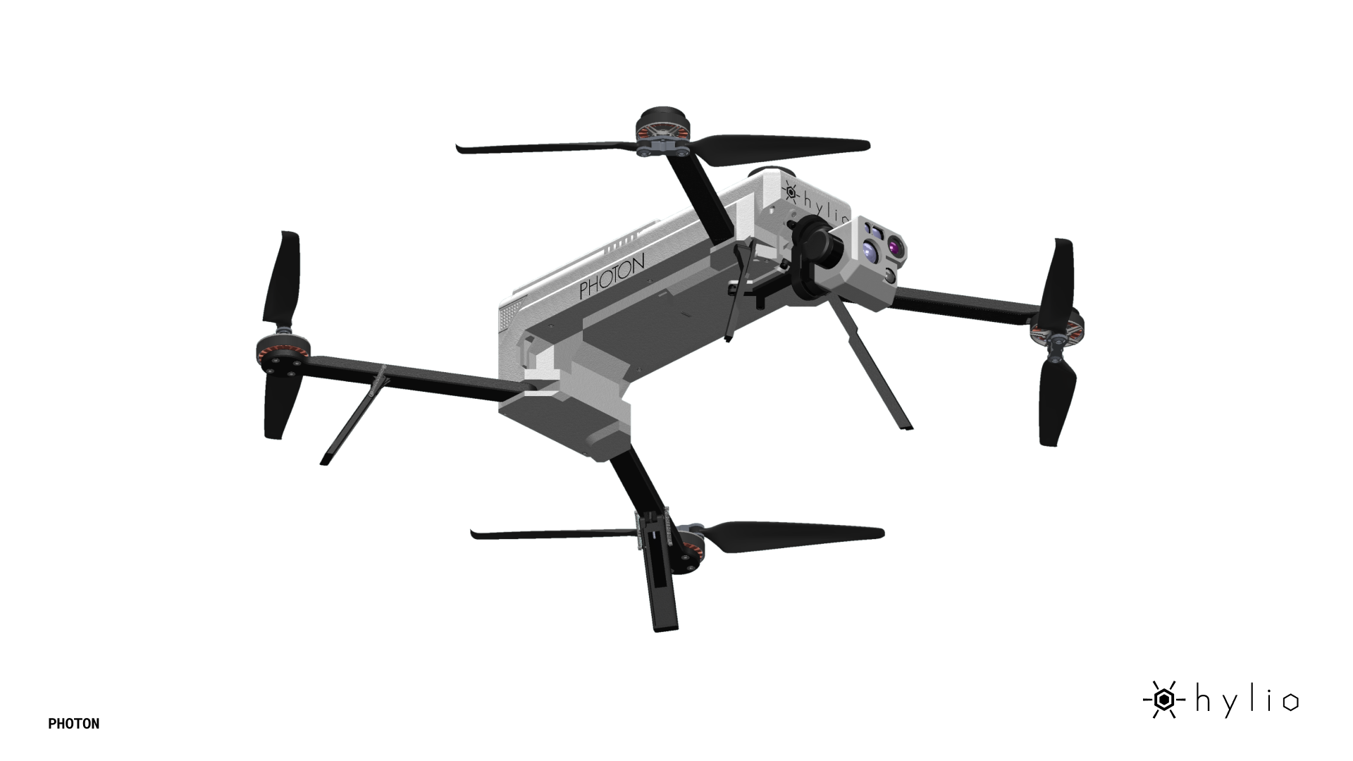
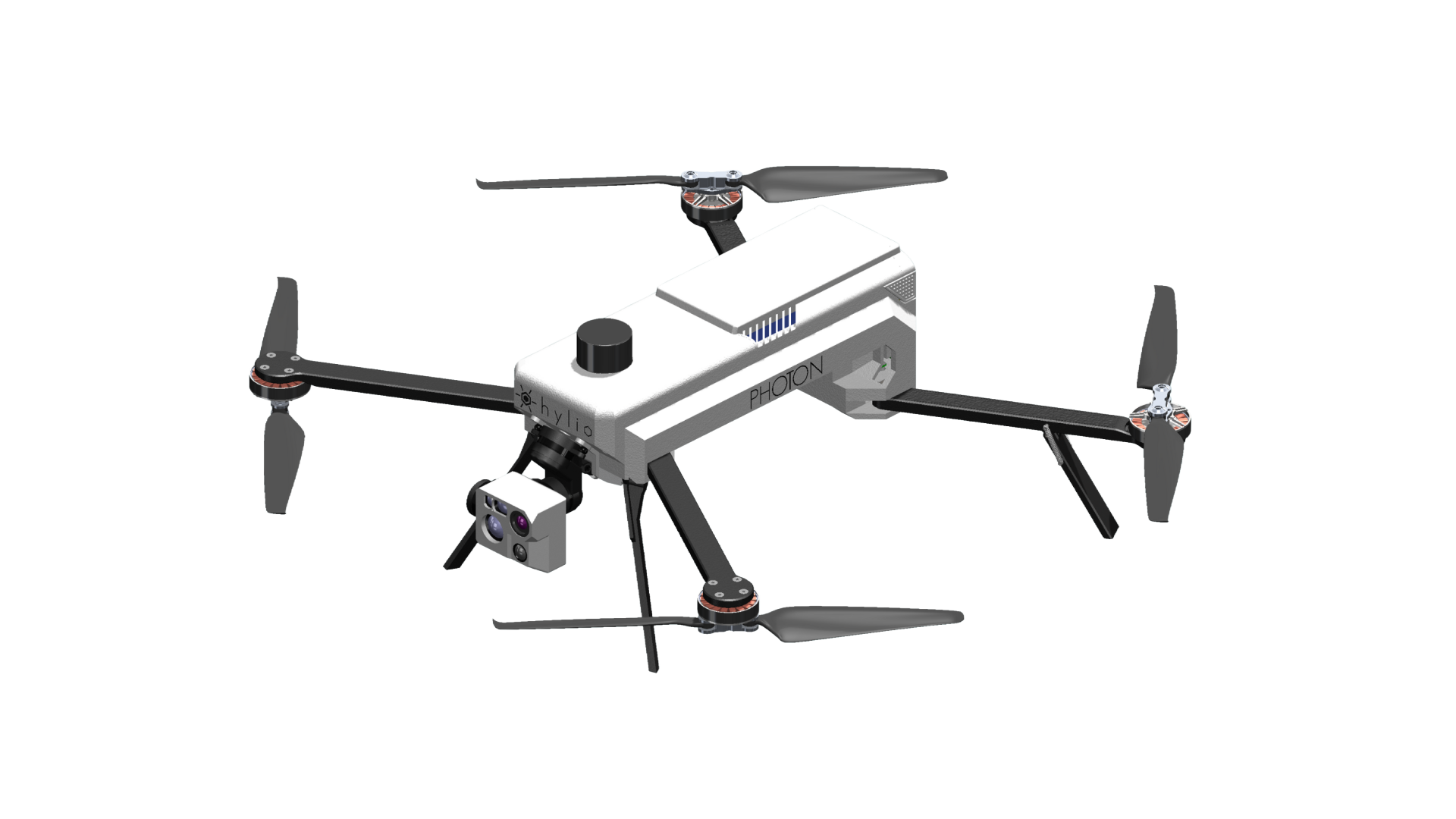
PHOTON is an American-made, backpack-portable UAS designed for rapid deployment across public safety, defense, agriculture, and industrial applications. With up to 55 minutes of flight time and centimeter-level RTK accuracy, it delivers precise, reliable data for mapping, inspection, and ISR missions. Its modular payload system supports thermal, multispectral, LiDAR, and high-resolution RGB sensors, allowing operators to tailor the platform to their mission. Secure AES-256 encrypted communications, onboard AI, and omni-directional obstacle avoidance ensure confident operation in complex and demanding environments.
The PHOTON is an American-made unmanned aerial system built to deliver reliable, actionable intelligence across defense, public safety, agriculture, and industrial applications. Designed for versatility and rapid deployment, PHOTON combines extended flight endurance, advanced sensor integration, and secure communications in a compact, backpack-portable platform.
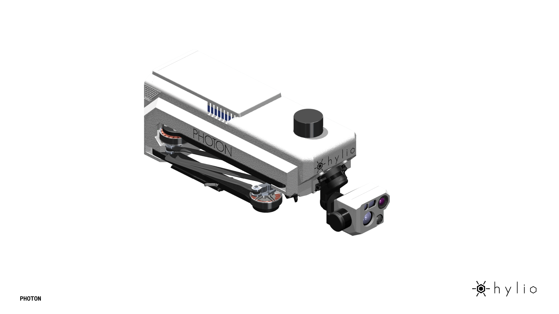
With up to 55 minutes of flight time and RTK accuracy down to 1.5 cm, PHOTON enables precise data capture for mapping, inspection, and ISR missions. Its modular payload architecture supports a wide range of industry-leading sensors—including thermal, multispectral, LiDAR, and high-resolution RGB—allowing operators to configure the system for specific mission requirements.
PHOTON’s dual-gimbal configuration and optional quad-sensor setup provide enhanced situational awareness, while onboard AI and AES-256 encrypted communications ensure secure, real-time data processing and transmission—even in contested or remote environments. Omni-directional obstacle avoidance adds an extra layer of operational confidence when flying in complex terrain.
From rapid-response search and rescue to precision agriculture and critical infrastructure inspection, PHOTON delivers the flexibility, endurance, and intelligence needed to operate where it matters most.
- Flight Time: Up To 55min
- GPS RTK Accuracy: 0.6in.
- Obstacle Avoidance: Omni-Directional up to 65.6 ft.
- Weather Rating: IP55
- Max Payload Weight: 2.2lbs
- Empty Weight, No Battery: 3.1lbs
- Max Takeoff Weight: 7.7lbs
- Max Operating Speed: 33.5mph
- Designed and Made in America
Key Specifications
55 Max Flight Time
Up to 55 minutes of flight time (empty) and 35 minutes at max takeoff weight, enabling extended missions with fewer battery swaps.
RTK Positioning Accuracy
Delivers centimeter-level precision (1.5 cm / 0.6 in), ideal for surveying, mapping, and inspection workflows that require highly accurate data.
Modular Payload System
Supports a wide range of sensors—including thermal, multispectral, LiDAR, and high-resolution RGB—through a flexible dual-gimbal configuration.
Secure Communications
AES-256 encrypted communication via 2.4 GHz and LTE ensures secure data transmission in sensitive or mission-critical operations.
Obstacle Avoidance
Omni-directional obstacle detection up to 65 ft (20 m), enhancing safety and confidence when operating in complex environments.
Portable, Field-Ready Design
Lightweight, foldable airframe designed for single-operator deployment and easy transport in the field.
Public Safety
IP55-rated and deployable by a single operator in minutes, PHOTON provides immediate situational awareness for incident commanders during disaster response and emergency operations. Thermal EO/IR sensors detect heat signatures for search and rescue, day or night, while high-resolution RGB imaging generates real-time orthomosaic maps for resource allocation and damage assessment when every second counts.


Agronomic Analysis
Deployable across vast acreage with 55+ minutes of endurance, PHOTON delivers advanced multispectral and high-resolution RGB imaging to detect crop stress, nutrient deficiencies, and disease outbreaks before they are visible to the naked eye. Instantly generated prescription maps enable variable-rate application planning, empowering growers to optimize yield and resource efficiency across large-scale operations and research trials.
Professional Inspection & Mapping
IP55-rated with extended endurance for persistent monitoring in rugged and remote industrial environments, PHOTON enables precise inspection and asset management across pipelines, energy infrastructure, and mining operations. Advanced sensor options, including LiDAR and high-resolution RGB, capture highly detailed 3D and visual data for accurate measurements, volume calculations, and fault detection across expansive facilities where safety and data accuracy are paramount.

Talk To Our Experts
Get in touch with us to schedule a meeting with one of our team members at MultiCopter Warehouse, where we can discuss and tailor the perfect solution for your needs.
